
6 Global Positioning Information Model overview
6.1 Overview
The information model provides different levels of providing global position and location information.
6.2 Global Position
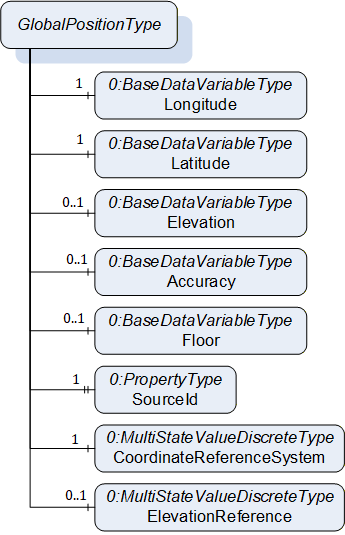
The global position provides information about the latitude, longitude and optionally the elevation of a position, according to a coordinate reference system for the latitude and longitude, and an elevation reference for the elevation. The coordinate reference system can for example be EPSG:4326 as used by GPS. The elevation reference is typically relative to a floor level.
In order to provide the global position, the GlobalPositionType VariableType is used (see 8.1). In Figure 6, the GlobalPositionType is shown, providing the main information as value (in the GlobalPositionDataType) as well as subvariables for individual access, and additional information like the coordinate reference system. The SourceId Variable provides the identifier indicating which tracking system or device generated the position data.
The SourceId Variable plays a critical role in this context by identifying the origin of the position data. It represents a unique identifier that indicates which tracking system or self-localizing device generated the location information. This identifier may correspond to a zone or foreign identifier associated with a real-time location system, or it may denote the unique identifier of a device capable of self-localization (for example, a UWB (Ultra-Wideband) tag operating in GPS mode).
6.3 Global Location
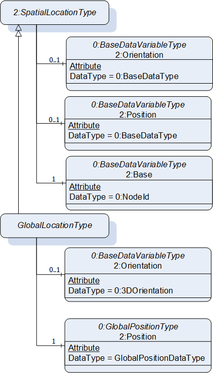
The global location uses the global position as base to provide the global position and adds information about the orientation in the GlobalLocationType VariableType (see 8.2). It provides the main information as value (in the GlobalLocationDataType) and in addition, the position and orientation as subvariables with additional meta data. The orientation is used as defined in OPC 10000-210. In Figure 7, the GlobalLocationDataType is shown.
6.4 Zones
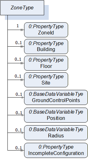
A zone defines an area in which a location is computed. A zone translates local locations related to the area of the zone to global geographic locations. A zone is defined by the ZoneType ObjectType (see 7.1). In Figure 8, the ObjectType is shown.
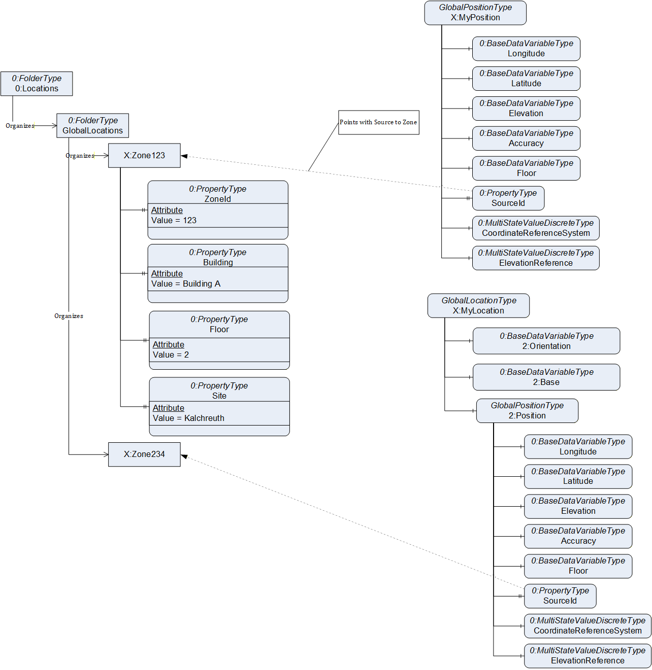
The relation between zones and the global position and global location is shown in an example in Figure 9. The global position Variable X:MyPosition references with its SourceId Variable the X:Zone123, and the global location Variable X:MyLocation with the SourceId Variable of its position the X:Zone234. The GlobalLocations Object defined in 10.1 is the standardized entry point to zones provided by a Server.
6.5 Connecting trackable Assets to global position and location information
You can put the variable GlobalPositionType or GlobalLocationType on the object you are tracking. The value should relate to the current and most significant location of the tracked object. E.g., if the object is tracked using multiple different locating technologies, the location with the highest accuracy should be assigned.